It took me 30 years to rediscover how much I liked walking in the woods, so I guess it’s an improvement that it took a mere nine months to discover a park that suits me almost perfectly.
 South Mountains State Park is about 80 miles southwest of my doorstep — longer than I’d prefer but considerably closer than the Blue Ridge Parkway and beyond. What I like about it:
- 40-plus miles of trails and a sprinkling of backcountry campsites. Most of the nearby parks are hiked out in a couple weekends, whereas it’d take at least a month — and some overnighters — to hike all of South Mountains’ trails.
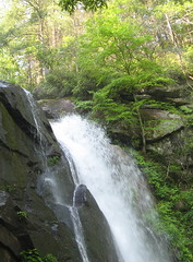
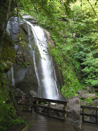
- One great waterfall, many water features. Upper Shoals Falls pours over a 70-foot cliff face just a mile from the main trailhead. Actually, the cascade coming down the rocks after the falls is more scenic (and photogenic).
- Hills on all sides. South Mountains is at the eastern edge of the southern Appalachians. While we have a few high peaks nearby, they all look out over farmlands and civilization. South Mountains is much more hilly, and seems much more wild. Elevations top out just under 3,000 feet; climbs of over 1,000 feet are abundant.
- Mostly pine forest. Pines are just more pleasant to walk among compared to the deciduous tangles we see at lower elevations.
I owe a major thanks to Smoky Scout, who took her Girl Scout troop to South Mountains a few weeks back. If it hadn’t been for her pictures of the waterfall, I might not have even noticed this park. Like all the other hikers who hang out in the flatlands, my gaze settles on the higher peaks farther west. But this place’ll definitely do if I’m not in the mood for a longer drive.
So about Saturday’s hike: Nine-mile loop with over 2,000 feet of ascent; that qualifies as strenuous in my book. Trails: High Shoals Falls Loop >> Raven Rock >> Little River >> Sawtooth >> Chestnut Knob.
I had only two destinations in mind: High Shoals Falls and Chestnut Knob Overlook. The most expedient way to see both is to hike up to one, hike back to the trail head, hike up to the other, and hike back again. Hiking to the top of the falls means 600 feet of climb; hiking to the overlook means 900 feet. Either way, lots of legwork.
Or you can cobble a loop together. I suspect my nine-miler is about the shortest way to do it. Let’s see the pictures.
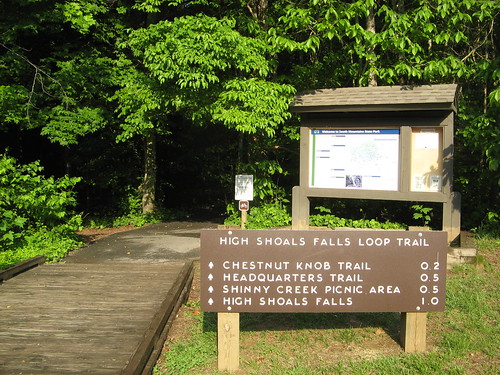
The road into the park ends in a big parking lot at the main trailhead. From here you stroll through a picnic area; it’s a right turn over to a gravel road toward the falls.
I got there early enough to catch the last of the morning fog burning off. It was blue skies to the horizon for most of my hike (by late in the evening a series of thunderstorms rumbled through).
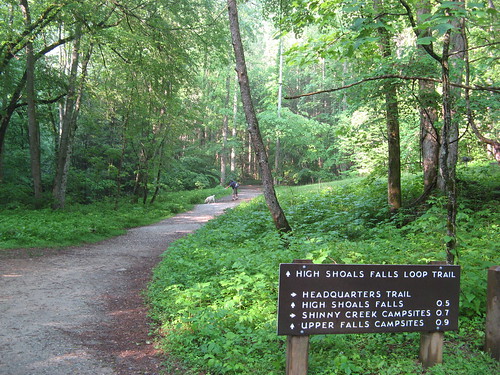
The road narrows at this point with the Falls trail bearing left. Rain the night before left the forest a shimmering shade of green.
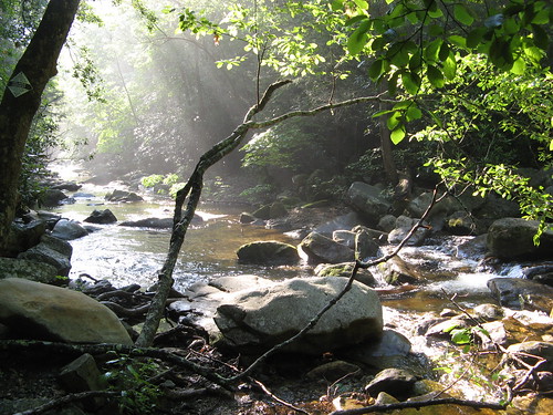
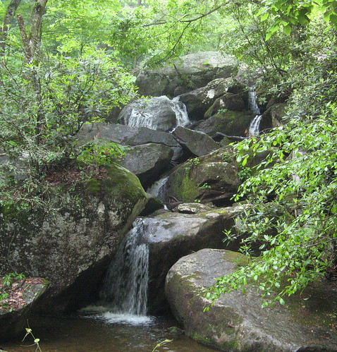
The creek pours through large boulders; it’s not far to the falls from here. Mind you there’s a long series of wooden stairs to climb; it’ll tire you out quickly if you try taking it too fast.
I had the falls to myself — mainly because I was one of the first hikers to arrive in the park. This area gets much more crowded later in the day.
After I climbed to the top of the falls, I crossed a bridge and followed the trail to an intersection near the Upper Falls Trail campsites. I took a left turn on a trail that passed through the campsites, crossed a creek, and climbed a ridge to the Raven Rock Trail junction.
One scene from a break in the trees. Most of the rest of this hike is on old logging roads, with lots of folks on horseback for company and hardly any hikers.
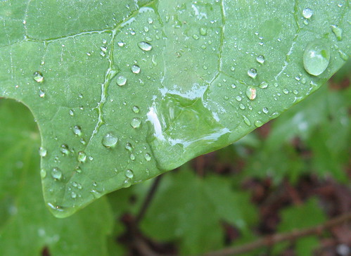
Friday night’s rains had not dried out.
At Raven Rock junction I headed left toward the Little River Trail, which dives back to trailhead level, crosses the park road and starts climbing again. My Bay Area pals steeped in the straight-up-the-hill traditions of Henry Coe State Park would feel right at home here.
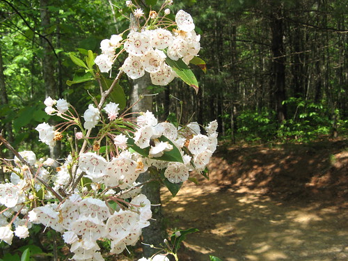
These wildflowers were abundant. Can anyone identify them?
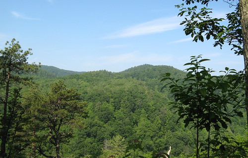
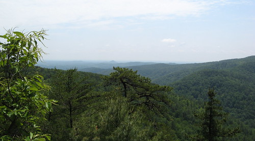
After a brutal initial climb on the Little River Trail, it was mostly up-and-down till I reached the Upper CCC Trail, where I turned left and headed toward the Sawtooth Trail. A left turn and more climbing took me to the Hickory Knob Overlook, which has amazing vistas.
Not bad, eh? Note this area is very rocky, so watch your step.
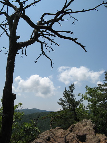
Naturally, I had to work a dead tree picture in somewhere.
After the overlook, it’s two miles back to the trailhead. Only the last .7 is notably steep, the rest is a gentle downgrade through a pretty pine forest. Nice way to rest up and cool down after so many uphill slogs.
Note if you’ve never hiked here: most of the trails are multi-use: some allow mountain bikers or hikers. The majority are not hiker-only.
South Mountains is on my must-return list. It’s reasonable to expect the rest of the park isn’t as sexy as its signature attractions; still, the miles in between were quite nice on Saturday. Only thing holding me back in the short run is summer’s advance: low-elevation hikes are bound to be sweat-fests in the months to come, so I may seek out higher terrain just to escape the heat.
Links for this hike:
- Everytrail GPS tracks.
- North Carolina state parks page.
- At-a-glance page at hikewnc.info.
- Reservations page for South Mountains.
- N.C. Waterfalls page.
- Recent blogger outings: May 4 | May 3 | April 20
Google map for Saturday’s hike.
View 5-15-10-South Mountains State Park in a larger map

Instead of seeking out higher terrain in the summer just pack an inflatable tube in your backpack and enjoy a lazy river float.
Temping: there’s a lazy river less than a quarter mile from my house.
The wildflowers in your pictures is Mountain Laurel (http://en.wikipedia.org/wiki/Kalmia_latifolia).
Well, I will never be the photographer that you are – thanks for showing your fans what SMSP really looks like!
I’m so glad you’ve discovered South Mountain! It’s my favorite NC State park, and over half of it is still inaccessible by trail (in the planning stage). It’s also one of the only parks where you can backpack camp, bike in camp, or horse camp. My major complaint with NC State parks is that most do not allow backpack camping. Still, there are plenty of beautiful places and things to see on shorter trips. You might also enjoy Hanging Rock for a couple of great day hikes.
Great pictures and report as usual Tom! Some of the pictures remind me a little bit of Big Basin. It makes me wish I was there! How are the ticks and mosquitos? I hope they are too bothersome. The ticks have been really active at Henry Coe this spring and a lot of people are getting them. I did a little backpack with a group down to Poverty Flat with a Sierra Club backpacking class this past weekend and they were a problem. I didn’t get one but I sure got eaten up by mosquitos. Yikes. It was great to get out though!
Great information and very beautiful pictures / sites indeed. The waterfalls is just stunning. It makes you want to go hiking all the time and enjoy the sounds of wildness and forget all the madness of everyday life. Again, great info.
Tom, what a nice discovery! Looks like a place ol’ Gambolin’ Man could get fired up about!