I never tire of the Marin Headlands. I drag all my visitors to see them — I even took my Mom up there in the middle of a blinding rainstorm (“there’s a spectacular coastline over there,” I promised, pointing to a fog bank). Melissa and I took her Mom to Fort Cronkite to watch the surfers on Christmas Day one year.
About the only thing I hadn’t done at the Headlands was hike, an omission somewhat corrected on Sunday. Last Thursday I’d gotten a “guess what I’m in town” e-mail from Rick McCharles of “Best Hike” fame (Rick has a hiker in every port), so I decided to take Rick to the Headlands as well. Last time we did an excellent 10-miler at Mount Tamalpais; this time we threw ambition to the wind and mostly wandered around, soaking up the view, doing only as much hiking as circumstances required. Which was not much, with so much scenery to distract from one’s trekking duties.
May as well let the pictures do the talking:
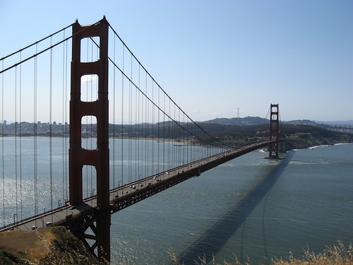
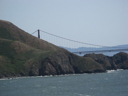
The classic “Golden Gate Bridge from Battery Spencer” shot. This is just beyond the first parking area you see as you head up the hill into the Headlands. From that lot, you can also walk down to the ocean along the Kirby Cove Road, a fact I overlooked while we were stopped here, so that classic hike got left off the itinerary.
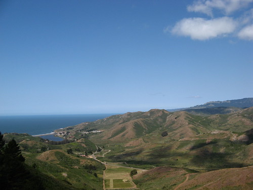
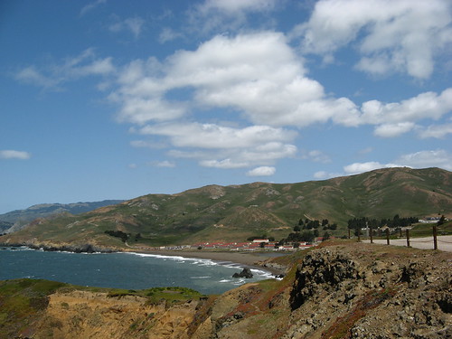
Next up, we parked near Hawk Hill, which has an impressive 360-degree panorama. This shot looks north toward Fort Cronkite.
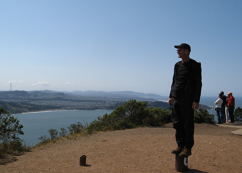
Rick engages in the quirky behavior that endears him to trekkers the world over.
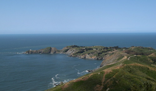
That’s Point Bonita — we checked out the lighthouse there awhile later.
I’m pretty sure Calla lilies are non-native, but they are nice to look at.
I like images where bridge cables parallel the slope of the nearby hills.
Another north-looking shot, this time from Battery Mendell, which is where you run out of continent when you drive through the Headlands.
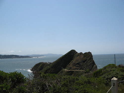
OK, on to Point Bonita, which has this very impressive jagged rock face nearby (wish I had an equally impressive picture).
The tunnel to the Point Bonita lighthouse is locked behind a steel door most of the time, but Park Service volunteers open it on Saturday, Sunday and Monday afternoons from 12:30 to 3:30 p.m. — note to visitors: if you go right at the opening, you’ll encounter a line of people waiting to get across to the lighthouse, which is very small and doesn’t have room for many people. Better to get there a little later in the afternoon.
Only two people are allowed on the old bridge to the lighthouse, which creates a traffic jam initially because you have to wait for people coming and going. Also, once you get over there it’s a lot windier, and hence chillier; dress appropriately.
A poster shows all the ships whose crews encountered a certain sinking feeling after having run into the continent .
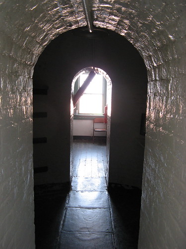
Inside the lighthouse.
With the lighthouse tour finished, we wandered over to Fort Cronkite to hike a bit of the Coastal Trail.
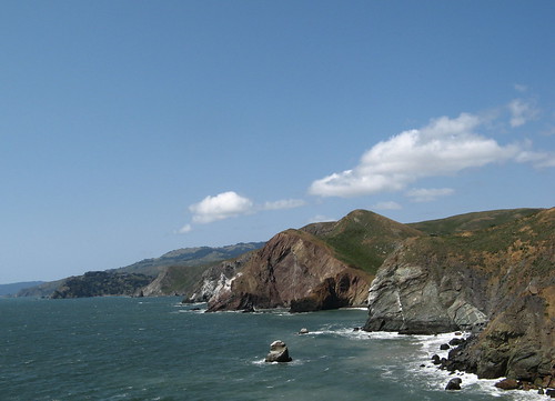
The stunning, jagged coastline never quits.
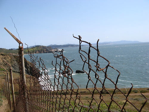
We walked along some ragged old chain-link fence that used to warn people they were wandering too close to essential military operations. Which, it turned out, were essential only to the profit margins of the defense contractors who built all the now-decaying installations in the Headlands.
Those are the highlights. Bottom line: The Headlands are far better for gawking than hiking. Riding a bike might be as much fun or more. Checking out the Point Bonita lighthouse is a must, as is, I’m sure, the Kirby Cove hike we skipped. It’s probably a bit too crowded and tourist-infested for the Global Hiker Elite of which we all members, but there’s no denying it’s got the most spectacular scenery per square foot of any Bay Area locale.
Marin Headlands links:




Hiya! Just found your blog a few weeks ago and love reading up on all the updates! Glad to meet a fellow bay area hiker. 🙂 I was out at point Bonita last fall – gorgeous area and love the bridge to get there – the day we were there the wind was strong so two people going across the bridge alone with high wind… well, it was worthy of an adventure movie. 🙂 Thanks for the pictures – reminds me I’ve got to get back out that way this summer!
Z.
hi tom. i managed to hike down to kirby cove the same day i went to point bonita. i wanted to see the light house but i couldn’t afford the wait. did you see the volunteer geologist while waiting to cross the bridge? i have a couple of pictures here (scroll down).
http://schmeebot.com/nid/1246.htm
where are you hiking next? would you consider letting me tag along? also, how much does it cost to join the global hiker elite?
I disagree that Headlands are not good for hiking. There’s an absolutely great hike to be had starting at the Spencer Avenue exit on 101.
Morning Sun Trail -> Alta Trail -> SCA Trail -> Coastal Trail -> Slacker Trail (Viewpoint) -> Back to Coastal Trail -> Miwok Trail -> Rodeo Beach to hang out and people watch
Then Miwok -> Rodeo Valley -> Alta -> Morning Sun
It’s a long hike, but you get an amazing view of the the bridge, San Francisco AND you include the ocean.
This is an absolutely great hike. The day I went, there were very few hikers out.
Carl: thanks for the tip … looks like it’s necessary to get away from the prime tourist areas to find the good hiking.
My philosophy is the touristy areas must be experienced and gotten out of the way; I’ll put your suggestions on my list.
Twee: Reading the blog is the price of admission to the Global Hiking Elite. Owning a blog in which you post accounts of your hikes puts you in the elite of the elite. I usually hike by myself because everybody else with two working legs walks much faster than I do. Rick makes an exception to his usual pace when he’s in town, out of politeness.
Marc: thanks for the encouraging words … that bridge is a doozy; the weight limitation thing had me a little worried, truth be told.
Wow, looks like one impressive place. I appreciate that someone else shares my taste for slow hiking. Hey man, we’re the ones noticing the scenery everyone else is breezing by!
Awesome! I plan on hiking the Headlands to Muir Beach, then to Stinson, and into Mill Valley this summer. I love that area! Thanks for sharing.