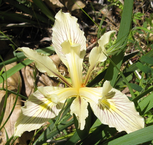
I’m seeing hints of wildflower season — lots o’ poppies on steep, sunny hillsides, mainly — but I can’t be everywhere so I figured I may as well ask what the rest of you are seeing out there.
So, let’s have it. How many? Where? How do they compare with previous years? What are your favorites? To get you in the mood, here’s an iris I saw last year at Sanborn Skyline County Park:
More wildflower links:
- Jane’s collection at BAHiker.com
- Henry Coe State Park wildflowers.
- California Academy of Sciences wildflower site.
- Flickr pics tagged “Bay Area Wildflowers”


I hope to survey Coe this weekend, mostly in the fire-damaged areas of Bear Mountain Road and Blue Ridge. I’ll try to remember to report back.
I would very much like to know because I am hoping to get out there with my cameras and tripod and take some good pictures of them, both digital and film. I’m hoping to do some creative stuff with multiples and slide sandwiches on the film side and so carrying all this stuff will be a pain and I won’t won’t be up to hiking 20 miles for it. 10-12 miles in and out would be OK and if you see good displays in that hiking distance, I will be very interested. Thanks!
I’ve been seeing only a few early season varieties out, but not in impressive numbers. It’s still too early for the best displays. I hiked Blue Ridge last Saturday and saw some nice displays of Indian Warrior on Hobb’s Road on the way down to the creek. The week before that I hiked Pacheco Falls and saw a lot of Shooting Stars and a lot of Hound’s tounge.
http://www.flickr.com/photos/85908626@N00/sets/72157604109068323/
http://www.flickr.com/photos/85908626@N00/sets/72157604050314129/
I suppose I should start tagging my photos better.
Randy: nice work!
Thought you might be interested in these three less common varieties that are currently blooming in Annadel State Park, near Santa Rosa: Redwood Orchid {Calypso bulbosa} Scarlet Fritillary (Fritillaria Recurva ) and White Fritillary (Fritillaria liliacea).
http://picasaweb.google.com/qlobata/Wildflowers
The pictures are ones I’ve taken in the past, but I confirmed that they are blooming and I have a hike going on Sunday March 16 to view them.
Just got back from a wildflower hunt…I took a chance and went further to the E than normal to San Luis Reservoir and after some unsatisfactory hiking terrain on the E’rn side I went to the W to Pacheco State Park, never heard of it before this trip, and its absolutely amazing!!! I’ve never seen so many flowers….I’ll be posting plenty of pictures and I suggest heading that way if you’re in the area.
Also I went to Coe and didn’t see too much activity near the Frog Flat Trail/ Hobbs Rd loop
Pinnacles was starting to bloom last weekend – it will be great in a few weeks. Lots of shooting stars, milk maids, and Indian Warrior. The Lupine was just starting to bloom, as were the poppies. And watch out for that poison oak – I’m suffering from my first rash of the season, probably from when I was brushing some aside to get a better look at some flowers on Rhus Ridge.
I’ve just recently started tracking my wildflower photos in a separate blog, http://www.calipidder.com/wildflowers/, mostly so that I don’t have to re-learn names every spring and can remember where I’ve found good displays in the past. I have hundreds of photos to upload from years past; I’m sure I’ll get around to it in my abundant spare time.
It’s been on the cusp at my favorite local haunts, such as Morgan Territory, Del Valle, Sunol. I’m bettin’ the big bloom will begin within a couple of weeks, if the weather gets warmer.
Next weekend I’m camping out with a bunch of Backpacker.com forum folks at the Carrizo Plain Nat’l Monument. If you’ve not experienced the bloom here…well, you’ll never forget it if you catch it just right. We’ll be at Selby CG, one of only two in the entire Monument, and it’s free. Come hang out with us!
To follow-up, I hiked sort of a figure-8 loop from Coe HQ, over Hobbs Road, past Frog Lake, up to and down Middle Ridge over Mt. Sizer to the East Fork Coyote Creek, north along the creek to Long Canyon, up to the top of Long Canyon and back down Water Gulch, upstream along East Fork Coyote Creek to the park boundary, and back via the Narrows Trail and Poverty Flat Road.
There’s a lot of charcoal up there, but also a lot of green. As others have said, the fire did some good things in clearing a lot of choking underbrush. It also leveled all of the tall, dry grass that makes crossing open fields so unpleasant. Some areas look totally sterilized, while just a few minutes down the trail, the damage looks minimal.
I saw the most flowers along Coyote Creek in the lowest elevation areas. I’ll bet if someone had the time to get back into the far eastern parts of the park, they’d get quite a display. We saw some poppies and quite a few shooting stars coming up, and a lot more I wasn’t prepared to identify.
I’d say the area new headquarters will be in major bloom in 2-3 weeks. The areas down in the large creek valleys perhaps a week or so sooner.