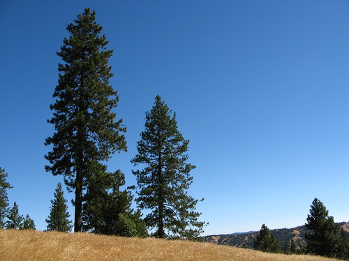
This was in Thursday’s Mercury News: quick looks at four great places to be in the springtime.
I imposed my affection for Henry Coe State Park upon the Merc’s tender readers, but I was merciful and recommended the wonderful Ponderosa Trail.
My piece is here:
Spectacular views of the South Bay and Diablo Range make the flat, easily accessible Ponderosa Trail an oasis from the long, steep routes passing through Henry Coe’s 87,000 acres of high ridges and deep gullies. Spring rains turn the hills a shimmering green, setting the stage for the return of wildflower season. And after the view, there’s the vibe: Walking through the stand of ponderosa pines towering over the 3,000-foot ridge top will seem strikingly familiar to those who’ve hiked Yosemite or the High Sierra (minus the spectacular rocky peaks, of course). You won’t get that anywhere else in the South Bay.
The rest:
North Peak Trail, Mount Diablo State Park:
The hike to the peak offers spectacular views and a wilderness experience that visitors to the mountain’s top don’t even come close to. From the top of the peak, the panorama stretches from the Golden Gate Bridge across the delta and the San Joaquin Valley to the snow-capped Sierra. Late winter and spring are particularly good times for this adventure.
Cataract Creek Tral, Mount Tampalpais State Park:
In the spring, the Cataract Trail boasts one of the highest concentrations of waterfalls in the San Francisco Bay Area. Cataract Creek stretches three miles and drops 1,200 feet in elevation as it plummets down the mountain from Rock Spring to Alpine Lake, and the Cataract Trail parallels it every step of the way. The upper 1.2 miles from Rock Spring to Laurel Dell picnic area are mildly strenuous with a modest, but steady slope. The lower 1.8 miles from Laurel Dell to Alpine Lake are steep.
Montara Mountain, near Pacifica
The trail climbs from an elevation of 200 to 1,600 feet, making this a very doable hike that has a little of everything. The real payoff is the end of the trail where, weather permitting, the expansive view includes nearby verdant valleys, Mount Tamalpais in Marin County, Mount Diablo in Contra Costa County and Sutro Tower in San Francisco.
Each link includes driving directions if you want to check ’em out.


I agree with you Tom, the Ponderosa Trail is wonderful. In fact I think that is my favorite spot in Henry Coe and that is where I took my friend last week. It was windy but it was otherwise a nice day up there. After doing the loop we went over to visit the Coe Monument on Hobbs Road. Then it was down the hill to Manzanita Point Road and out to that picnic table where Poverty Flat Road meets up at the top. And after a leisurely lunch there, we took the Springs Trail and Corral Trail back to park headquarters, making for about 5.5 miles and just under 1000 feet of elevation gain according to my GPS. It was a good day out, not too long for a Coe first timer and still gave a nice taste of the park.
Montara Mtn is a great place – and you’ve reminded me to get back there since so far I’ve only hiked it up into the thick fog. I hear there is a nice view from up there. 🙂
I’d also recommend Garrapata State Park, about 5 miles south of Carmel. The wildflowers and views are stunning on a clear spring day from the ridge, and there is a canyon trail that parallels a lovely redwood forest creek.
Russian Ridge is always a good beginner/intermediate hike in spring. In clear weather you get good views, and the wild flower displays are usually very good. Not much elevation gain. You can also connect with other MidPen trails and make it an all day hike.