There’s a large lake about a mile from here …. you don’t see anybody swimming or water-skiing in it because it’s there for one reason: to store rainwater that makes it possible for people to live in California for the six months out of the year when there is no rain. The dry spell is also why the hills turn yellow every June: the grass is alive, it’s just hibernating till the rains return in November. Anyway, this body of water called the Calaveras Reservoir is right next to the Sunol Regional Wilderness — which is as wild as the name implies, and just 10 miles up the road. It’s got scenic trails going every which way, so it’s a fine place for a day hike. Right across the road is the Ohlone Regional Wilderness, which has a trail going up to Mission Peak, which I climbed a couple weeks ago. When I got to the Sunol park, the first trail sign I saw pointed toward Mission Peak, so I figured I’d stick with a trusted brand and head in that direction.

Just a tiny slice of the Sunol Wilderness. It has craggy peaks, waterfalls and an area called "Little Yosemite." Lots to see here, so of course I went in the other direction.

If you look really close you’ll see little bits of something growing up between the cracks in these rocks. That grim determination to get a suntan is the spirit that built California.
This patch of trail goes for about a third of a mile, then crosses Calaveras Road. The Ohlone Wilderness Area is on the other side. You’re supposed to buy a $2 hiking permit and sign a register to walk the Ohlone trail. I didn’t know about the permit requirement; I saw a trail register but nobody had signed it in a month or so, so I figured the rule wasn’t being enforced, so I blew it off. There were signs on the gates into and out of the Ohlone trail saying permits were required, but I figured they applied to somebody else and went on my way.
After I had walked eight miles and didn’t see a human soul, it began to dawn on me why there was all this red tape: You could sprain an ankle or stand too close to a cow when it farts, but the real danger on these trails is fire. If one breaks out, firefighters check the trail register and try to rescue anybody who’s signed it. If you haven’t signed and they don’t know you’re up here, you’re toast. This realization took some of the fun out of my hike, but I didn’t need a near-toast experience to be convinced: don’t do this at home, kids: pay the $2 permit fee, and sign the trail register. That way if enraged California Condors carry you off and have their way with you, people will have an idea of where to start looking.
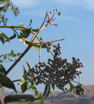
OK, back to the Ohlone trail. I’m trudging up the trail and I notice a section of a tree up ahead is bouncing hither and yon. Then I see these bluebirds dashing in and out of it.. when I got up close, I saw what they were after: berries.
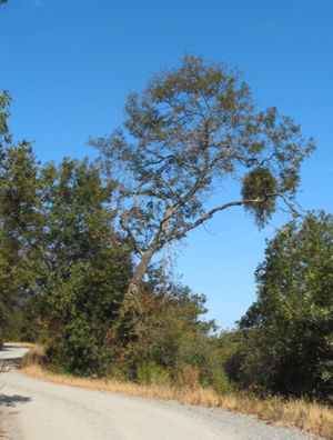
I figured something must be living in that big clump of leaves over there at the right on this tree. No clue what it was, but it made for a fresh entry in my "Cool Trees of California" file.

Speaking of fire, there must’ve been a doozy up here — this appears to be all that’s left of a stone fireplace.
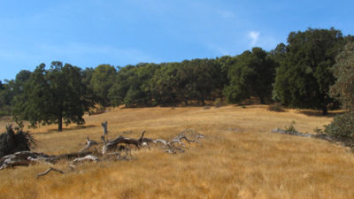
One of those alpine meadow shots — all you can hear is the breeze ….

… and the sounds of cattle seeking shade.
So, I walked a couple miles up the trail from here and got to the back side of Mission Peak. Classic "nothing to see here, folks" outcome… unless you’re willing to trudge that steep-ass mile to the summit. I figured, heck, I know what it looks like up there, and besides, I’ve got a two-hour walk back to the car, during which time I have to pray that wildfire doesn’t break out and strand me up here. So, back down the hill I go.

It hasn’t rained here since April, but there is a muddy patch of trail right ahead of me. It’s because of a little spring coming out of the hillside. These hills around here are dotted with these little springs, and each patch of forest is a little oasis in a bone-dry countryside.
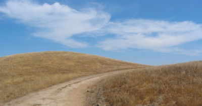
Here’s the trail about a hundred yards down from the spring. Good thing some clouds showed up to make things interesting.

This scene reminds me of "One-Tree Hill," that song on U2’s Joshua Tree album. Something amazing about how a hillside will have only enough moisture and nutrients to keep a single tree alive. Like it’s an accident of fate, yet inevitable. Deep, I know.
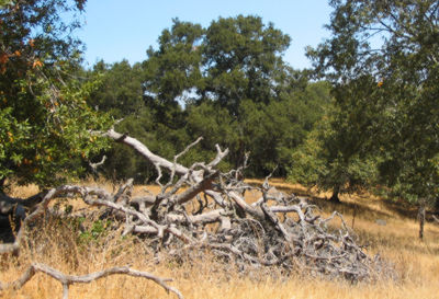
You see why people in California love trees so much: even the dead ones are interesting to look at.
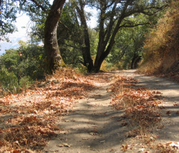
Several areas of the trail were littered with fallen leaves, as if it were fall-color season. It never gets cool enough around here to bluff a tree into thinking winter’s around the corner; some nasty tree blight seems like the most likely culprit.

If this tree could talk, it’d probably say, "stop your gawking and get up here and scrub all this damn moss off me. It itches like hell!"
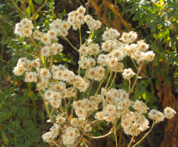
These blooms were about the size of a dime. This time of year, only the small flowers get to show off.
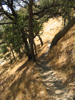
OK, the hike’s almost over. When I came up this way, it was an invigorating, challenging climb, marching uphill, staying on the narrow trail, avoiding the rocks. On the way back it’s just an annoyance, the feet screaming to the brain: "hey moron: if it’s steep, narrow and full of rocks at the beginning what do you suppose it’s going to be like at the end?"

Tom, these are great. Any chance you can post them so I can make them into wallpaper?
The one tree also reminds me of “Six Feet Under” and its opening credits.
How peaceful your walks seem!
Definite peace & quiet opportunities out there … sometimes the only sound is lizards running through the leaves.
And there’s the sound of animals moving through the brush. Totally undermines the premise of “Blair Witch.” It’s like: you morons, that noise in the woods is Bambi out taking a crap.
That’s pretty bucolic scenery! Well-composed photos, too.
Thanx, though I give myself more credit to cropping than composition — anybody can take better pictures if they know how to cut the nonessential stuff out and focus on the interesting stuff.
The “STRANGE CLUMP” YOU SAW IN THAT TREE IS MISTLETOE. Kind of a parasitic plant that gets its nourishment from the tree itself. Quite common actually.
I’m always scouring the maps looking for great places to hike – typically the Sierras or the coast. I forget how much there is in my own backyard. Thanks for the great pictures to drive home how great the Sunol area is – especially in the spring.