 Pilot Mountain is the real name that inspired the town next door on The Andy Griffith Show (Andy’s hometown is Mount Airy, which got Hollywoodized to “Mayberry”; presumably Andy approved it to protect the identities of Otis the Town Drunk and Earnest T. Bass, the stone-throwing lunatic). Remember how somebody was always heading over to Mount Pilot?
There is a little town called Pilot Mountain, right at the foot of the peak of the same name, which looks conspicuously like the place where Zeus might have been weaned. The nipple is actually called the Big Pinnacle, which rises to over 2400 feet, a tall peak indeed for these parts. (The Appalachian Mountains start rising in earnest about 100 miles west of here).
North Carolina Highway 52 runs right past Pilot Mountain State Park, and the peak rises like a volcano beyond your windshield as you drive up from Winston-Salem (just over 20 miles). Getting there is beyond easy: once you see the teat peak, just drive till you see the signs for the state park. Once you’re there, you can drive straight to the top. Here’s the route I ended up hiking:
Mind you this is just three miles of hiking, though my GPS says I had over 900 feet of up-and-down. I ended up in sweaty, exhausted lump afterwards (only thing not gassed: my feet — three miles is three miles where they’re concerned.)
Turns out if your first hike after five weeks of lazing around is on a 90/90 (heat/humidity) day, you’re going to tire out about three times sooner; lassitude plus air thick as peanut butter added about five miles to this hike (I’m banking the altitude excuse; someday I’ll really need it).
Just sayin’, not complainin’. Being a stinky hiker means I’m actually getting some hiking done. It’s better than, well, blogging about hiking, but I’ve kept y’all waiting too long already.
Frankly, this is a beautiful little three-miler, worthy of any of the hikes in the Bay Area; it’s much rockier than most of Bay Area trails and the vistas look out over open land, an improvement over suburbia. It has the layered stone you see in all the Appalachian Trail journals; the trails I hiked were very well groomed and not the least bit muddy despite a massive thunderstorm yesterday afternoon.
Of course the Triad is a big enough metro area (over 1.6 million) that discerning outdoorsfolks can nag the state into keeping things nice at their nearest neighboring state park. We’ll see how things are farther afield, though I wouldn’t be surprised to find most NC state parks in better shape than their California peers, given that California is a bit oversubscribed in the state park department.
Long as we’re on the subject: North Carolina seems like it’s turning into California anyway: I saw one group of South Asian hikers and noticed that at least half the climbers (out of a dozen or so) had a decidedly Yankee inflection to their manner of speaking, if you get my drift.
OK, enough blabbing, let’s see some pictures:
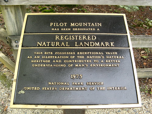
Yeah, it’s a national landmark and everything.
Parking is near the Little Pinnacle, which offers a nice overlook at the Big Pinnacle; you hike around the Big one, but not to the top. No climbing there either, which I’m sure peeves the belaying masses, but it ensures excellent strolling because you don’t have to step around ’em.
This little sub-one-mile out-and-back sets a high standard for future NC hikes. Rocky, shady, mostly flat. Heck, I’m not sure a strong rain would spoil it.
Something’s eating this leaf.
The trail to the Big Pinnacle splits but either way loops around the hilltop so it doesn’t matter which way you turn. This is the first big rock wall on my route.
Melissa noted this looks like a stone sandwich. (Note to self: look up why the stone is layered like this).
Trees grow out of rocks here, too. And I take their portraits.
Frankly if I were a climber I’d be galled that a nice formation like this one is off limits.
So on the way back along this route I saw this sign for the Ledge Springs Trail, which is billed as “2 miles strenuous.” There’s also a sign warning that straying off the trail and falling off the cliffs is bad for your health. I figured “how hard could 2 miles be?” and learned that if there’s enough up-and-down through a rocky trail on a steamy hot day you can run your battery into the red zone in short order. A shame because this, too, is an excellent little trail.
Another cliff on the Ledge Springs Trail.
These climbers had so much gear, it looked like somebody had crashed a plane carrying an REI shipment.
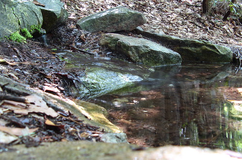
I suspect this is one of the Ledge Springs.
Stone also has fascinating colors in addition to the layers.
Just so you’ll know: East Coast buzzards are very large; perhaps not as ugly as the turkey vultures common in Bay Area skies.
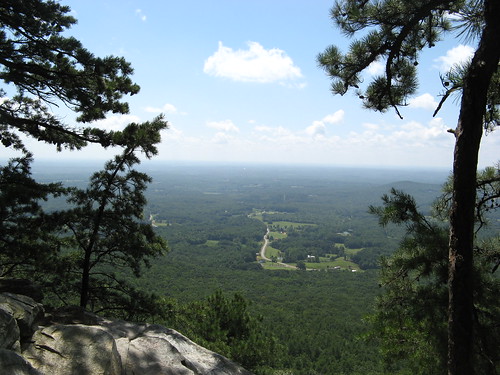
I took a use trail to this overlook and paused for lunch. Any park with views like this is aces with me.
Another view from the parking lot at the Small Pinnacle.
Overall, I’m psyched about the prospects of hiking around here. Of course it’ll be even better farther up into the hills, but it’s good to know there’s a nice park just down the road.
Pilot Mountain State Park links:
- EveryTrail GPS travelogue.
- North Carolina State Parks page.
- Pilot Mountain map (PDF download).
- NC state parks on Google Earth.
- One blogger’s account of hiking at Pilot Mountain.
- Longer loop at Hiker to Hiker.
View Pilot Mountain State Park in a larger map


Glad to see that you’re back on track literally and figuratively, Tom.
Can understand how your first in awhile, in the heat and humidity of August, would seem like a good workout even though the distance wasn’t much by your standards.
Two suggestions: Pisgah National Forest, east of Asheville.
Mt. Rogers is the highest point in Virginia. The Appalachian Trail goes to the top. Not far from the N.C. border, NW of Winston-Salem.
Hi Tom, welcome to NC. You hit it on a day that’s even extra humid by our standards! It looks like you had some sun to enjoy those beautiful vistas at Pilot Mt.
NC’s parks are limited and select, but thankfully so far they’ve been kept in good shape, with a lot of different variety from coast to mountains to explore.
Here in Raleigh, our closest state park is Umstead. The views are limited, but the trails are plentiful and a welcome escape from the urban sprawl literally in the back yard of the park. Sometimes, just having a nearby place to escape the concrete is enough to restore the soul.
Good luck and enjoy.
Very glad to see you back and welcome to the east coast… I hope you enjoy it over here.
Pilot Mountain is close enough for you to hike it once a month and see how it changes – and you will enjoy it much more in October when that humidity is gone. And yes, a little bit more driving and the really good stuff awaits!
Tom, looks like a great hike in a beautiful area! Great to see you back in the saddle, er on the trail!
Thanks… I was worn out but it was the good kinda tired.
You’re killing me Tom! I’ve been laying low most of the summer myself letting my knee heal up and now I’m ready for short stuff like that, except I’ll miss the heat and humidity thank you very much. Nice looking hike though and the views look look like they are to kill for. I’m sure you’ll be doing that one again. I can imagine the view when the fall colors come. Oh man! Be sure to post pictures!
Its good to see a hiking post and picts, though I did enjoy your x-country travel log.
As far as the rocks go (and this comes with all the caveats of me being a California geologist so what the hell do I know about carbonates….) But they look like limestones. With the lack of obvious cross-bedding, I am going to suggest that the layering is caused by annual deposition on a tidal flat.
Of course just suggesting this reminds me of one of my favorite lines from “Bored of the Rings”…
“As usual, the old wizard was dead wrong”
Beautiful pictures, Tom. I want to become a hiker.
Just curious: Have you been y’alling all along or are you reinventing yourself in even more ways in NC?
Great to see you back on the trail Tom!
Excellent report and photos – obviously a different type of hiking on the east coast with unique challenges and scenery.