After last week’s puny hike I figured I’d better put in a respectable one this week so I can show my face on the trails around here (not that anybody knows my face, but still). This time I set out from Bear Creek trailhead on the west side of Briones Regional Park. It’s $3 to park here but generally worth it; you can park free on the road near the entrance but it’s a bit of a haul into the park from there. You won’t mind it at the beginning but at the end you feet’ll be cussing that needless last half-mile.
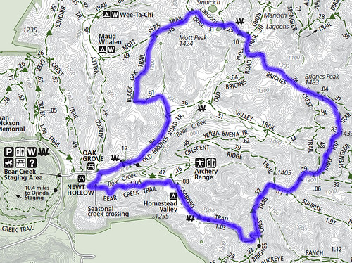
Heres the route I took:
The turns: Old Briones Road northeast to left turn on Black Oak Trail; right on Mott Peak Trail; right on Briones Crest Trail; spur on Table Top trail, then back to Briones Crest; right on Seaborg Trail; left on Bear Creek Trail and back to the parking area. It’s 7 miles and about 2,000 feet of elevation gain according to my GPS unit.
I’ve put in about 10 miles in two weekends and barely covered half the trails at Briones. I’m not even sure if this is one of the recommended loops at Briones, but I must say on a sunny spring day with blue sky from here to Jupiter, it’ll do.
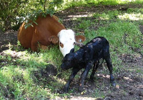
We’re not seeing poppies carpeting the hillsides just yet, though that’d just block the view of the shiny vivid green we get only for a few weeks from mid-March to the end of April. Also, Briones doesn’t get the throngs filling Tilden Park just a few miles away, so it’s a nice get-away-from-people place to hang out. I saw a few mountain bikers and missed a cow giving birth by just minutes (the calf was all wet and shaky-kneed, just like on the nature shows.)
Wildflower action was passable — I’m guessing the two years of light rain coming on the heels of an incredibly wet March in 2006 (which drowned everything) have set back the bloom perhaps for a few more years to come. Speaking of which, let’s look at some pix:
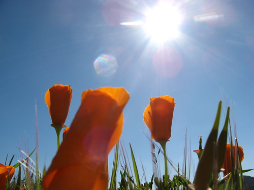
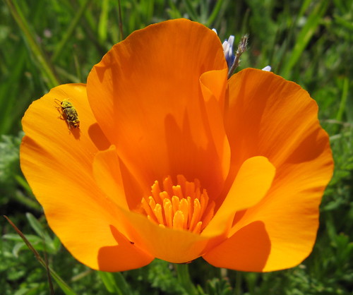
Poppies getting ready to pop in the morning sun. This is near the Black Oak Trail, which is really more like an old wagon path with one really steep dirt patch. Don’t go this way on a rainy day.
From Black Oak Trail, I headed up toward the Briones Crest Trail (hey, it has real fourteeners just like the Pacific Crest Trail. Well, they’re 14 hundred feet vs. 14 thousand; trivial differences if you ask me). The BCT is one of the nicest parts of the park, all snark aside.
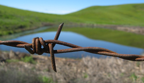
This area with a pair of ponds (the maps call them lagoons) is especially scenic.
Why do people tattoo barbed wire on their biceps? Same reason I took this picture: visual contrast.
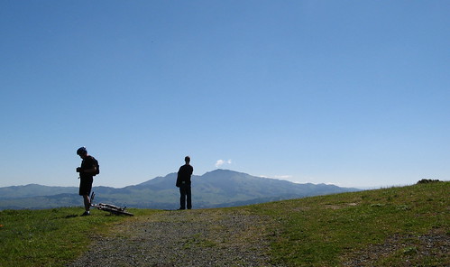
The crest trail eventually runs into the Table Top Trail around here. Views of Mount Diablo are awesome, and the blooms are abundant.
I take whatever wildlife I can get. I saw a few pretty butterflies but they never came close to camera range. Had to settle for this bug crawling on a poppy.
Poppies and Diablo. Nice combo.
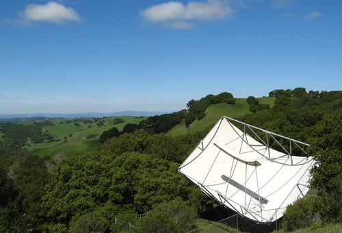
An enterprising anarchist scaled a fence and scrawled timeless wisdom on this satellite dish: “One day this unsustainable civilization will fall.” At which point there will be no more spray paint and the enterprising anarchists will have to get real jobs or learn to farm potatoes (either one would be richly entertaining.)
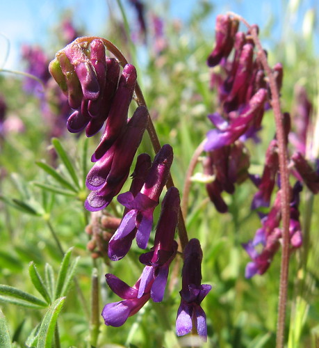
Winter vetches were also in abundance along the trail.
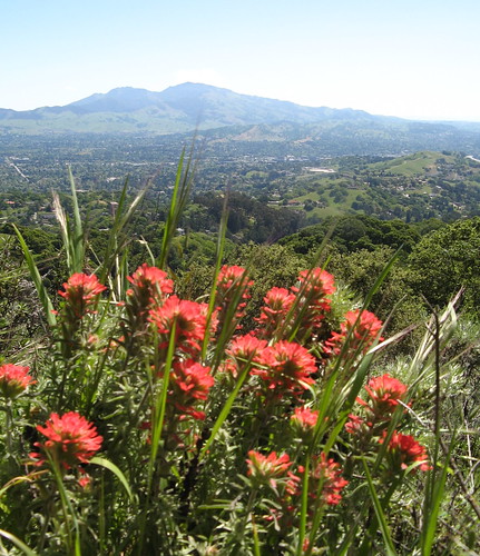
Indian paintbrushes (or perhaps Indian warrior, I can’t keep them straight).
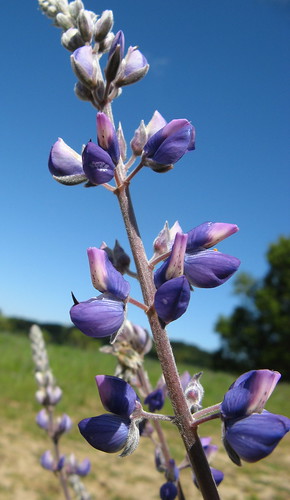
Big bush lupines are quite photogenic.
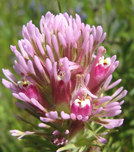
If you get the camera too close to the owl’s clover you lose the “owl eye” effect. Oh well.
OK, so I connected back up to the Briones Crest Trail and turned again at the Seaborg Trail. In the distance I heard considerable mooing of cows and my main concern became watching out for their poop patties. A small herd was hiking right up the trail toward me and I had to sorta tiptoe my way through them. It’s calving season and you don’t want to come between a mom and her baby. This gives mom the delusion that she’s a cape buffalo and free to charge anybody at will (usually if you holler and wave your arms enough, a charging cow will back down, but it does get a bit scary for a few seconds there. Always remember where the word “coward” comes from.)
Awhile down the trail I saw these two people watching something in their binoculars. It seemed odd that they weren’t looking up, where the birds are, but I gave no thought to it and hiked on past. Then I saw what seemed to me to be the sorriest-looking calf I’ve ever seen — Damn thing could barely stand up; I figured it was half-dead and drawing its final gasps. Then it hit me: the binocular couple were watching the pathetic little black wretch breathing its first, not its last.
As I walked past, I noticed something oozing from where the umbilical cord used to be; the calf was all wet and the cow was licking it clean (great time to have a tongue the size of Toledo).
The calf couldn’t have been more than a half-hour old. My brain celebrated the miracle of life for at least 15 seconds till it reminded me that one more cow means more crap to step around. (I met one hiker whose golden lab had thoughtfully rolled around in a cow patty, just to make the ride home interesting.)
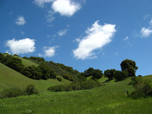
OK, one more picture and I’ll call it a hike:
See what I mean about the singular green we get this time of year?
I admit it’s kind of silly for Silicon Valley types to drive 50 miles to Briones, which is pretty much like all the Diablo Range parks much closer to home. The shorter hills at Briones make the hiking a bit more pleasant if you’re an out-of-shape slug like I’m turning into, and the views of Mount Diablo are fantastic. But if you live within 30 miles, Briones belongs on your list if it’s not there already.
Previous Briones links:
- Last week’s quickie wildflower walk.
- My first preview post on Briones
(Includes essential external links).
Everytrail GPS plots:



Nice hike! I need to get to Briones again – I’ve only ever hiked there once. As you say, though, it’s a bit out of the way given that you have to pass other great parks to get to it from nearly anywhere.