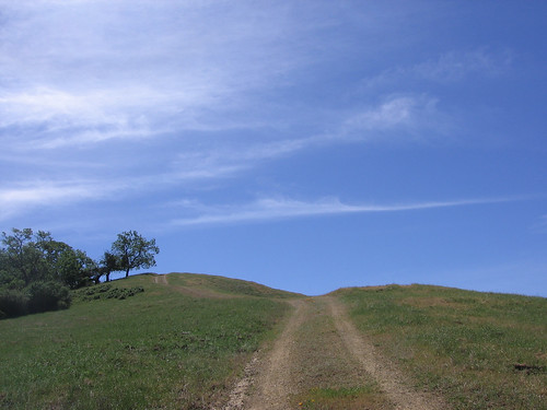
You have to check out the Washburn Trail at Joseph D. Grant County Park (AKA Grant Ranch). It’s the meanest trail in a park that has an abundance of leg-burners.
I saw a bunch of California poppies blooming on the open hills south of San Jose on Sunday, which means wildflower season is starting to sprout. Grant Ranch is among the best parks in the region to check out the bloom. There are easy ways to see some, like the Hotel Trail near the park HQ; moderate ways, like the Twin Gates trailhead, and then there is the Washburn, which Mike and Kathy and their FOMFOK crew checked out Sunday. (Pictures here, here, here and here). Mike’s known for leading relaxing, recreational hikes and generally finds ways to go down this route rather than up, so this one was a bit of a surprise. Here’s a GPS Visualizer map of the FOMFOK hike.
I was tempted to crash this hike but decided I had to see me some waterfalls after a month with no hiking. And I also knew my legs were in no shape for any of the hills at Grant, much less the dreaded Washburn (I hiked up it just once, on Mother’s Day of 2006; speaking of which, where have the last three years gone?)
Here’s a pic from that hike.
If you’re interested in checking out the Washburn, there’s one notable caveat: Your first mile is up Mount Hamilton Road till you come to a big gate near an old barn. You walk flat for about another mile, head down a ways and cross a creek, then slog up and up and up till the top (around 2,000 feet, I would guess). On clear days there are expansive views of Silicon Valley and the Mount Hamilton Summit. And in springtime the hills are the finest shade of green. You’ll need a few rest breaks, which can be expended gawking at the season’s latest blooms.
And if you’re hot to prove the adage that what doesn’t kill you makes you even more foolish, see “Steepest Bay Area Trails.”
More Grant Ranch links:
- My Joseph D. Grant Park profile, originally published in the San Jose Mercury News.
- All my Grant hikes.
- An idiot’s guide to orienteering.
- Bay Area Hiker’s page.
- Yelp reviews. (Ann L., our favorite Yelper, has been there, natch.)
- Flickr pix from Grant (check out the snowfall).
Google map for Grant Park.
View Larger Map


A group of us did that hike back in March 2004, as part of our training to hike Half Dome in May 2004. We went up the Washburn, down Canada de Pala, then Yerba Buena trail back to the lake. It was a great day for a hike. As we went up the Washburn, a coyote crossed the trail just a hundred yards or so up the trail from us.
Our photos are here (no coyote picture, though):
http://www.bulloch.org/img/JGrant/index.html